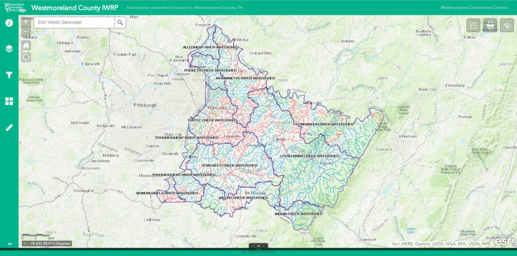
With our easy-to-use Interactive Mapping application, you can find information on watersheds, waterways, and everything water within Westmoreland County. Over the past several years the Westmoreland Conservation District has, in partnership with Ethos Collaborative, studied, analyzed, and produced a significant amount of valuable information related to water in local watersheds.
This interactive mapping tool will serve as a home for all information pertaining to the county’s Integrated Water Resources Plan, Model Stormwater Management Ordinance, and related data.